22-24 May 2019, White Pocket, AZ

One of the neatest places we’ve been is located near the Utah /Arizona border in Vermillion Cliffs National Monument. It took two hours driving a sandy 4×4 trail (in the rain) to reach our destination, White Pocket – and did I mention the clay dirt road leading to the trail – which was almost impassable when wet… We had to disconnect our Jeep to maneuver the trail!

Start of trail to White Pocket
2 hours later – entrance to White Pocket – Vermillion Cliffs National Monument

The rain actually made the sand a bit easier to drive on, but the long drive made the area very desolate – not many others attempted to explore this area while we were there.

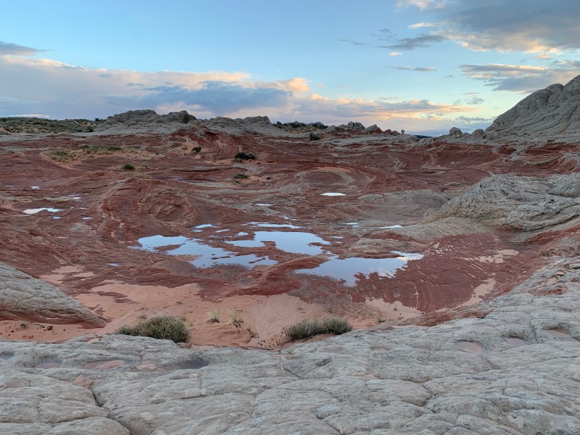
Once we found a level (and not so muddy spot) to camp, we began exploring the area. As we hiked around, I was taken with the thought that this would be a perfect spot for a Star Trek episode! There were so many odd features that it felt like we were on another planet. The colors and patterns of the rock were mind-blowing!

The ground felt like we were at the bottom of the ocean!
The textures looked like a giant quilt
Then there were giant “bites” in the white patchwork where the red and orange colors were amazing!
Chuck at White Pocket
Rock formations at White Pocket
Rock layers at WHite pocket – See how they suddenly switched from up and down to right and left – what happened in the history of this area to cause this?
Rock Formations at White Pocket – the colors were brighter as the sun peaked out!
White Pocket – seems like a good spot for a Star Trek episode!
Even the sand in the stream bed after the flash flood is multi-colored and patterned!
White Pocket Rock formations.
White Pocket rock formations
Rain finally clearing at White Pocket
Rock formation at White Pocket – like a giant slide!
We found Tadpoles in the rain puddles!
Sun finally shining at WhIte Pocket
Driving back – another two hours to the “road”
Heading home from Vermillion Cliffs National Monument.

What a cool, cool place!

22 May 2019, Antelope Canyon

Near Page, Arizona, there is an amazing sight on Navajo land. Antelope Canyon is a slot canyon, formed by water running through sandstone, and famous for the colors (which change based on the time of day and/or season). You can only visit with a Navajo tour guide, but luckily, the locals have set up tours that are run efficiently, and still allow you to take as many photos as you want. Here are a smattering of our photos. If you think they are cool, I probably have a hundred more!

Hiking Down to Lower Antelope Canyon
Inside Antelope Canyon
Lion’s Head formation
Looking up from inside Antelope Canyon
Inside Antelope Canyon
Smiling Face Rock
“Lady in the Wind”
Yes, we were both in Antelope Canyon!
Staring upward at one point – you can see the outline of a seahorse!
Climbing out of Antelope Canyon
Coming out of Antelope Canyon (looks different from the outside)

20-21 May 2019. Lake Powell AZ/UT

We took a little longer route back home, stopping at one of our favorite parts of the country, Lake Powell near Page, Arizona. The weather was still iffy- rain, bits of snow, and lots of wind. We camped for a few nights at Lone Rock BLM campground, right on the beach at Lake Powell.

Here is our camping spot at Lone Rock Campground
The Lone Rock (hill) in the middle of this part of Lake Powell is the namesake of the Lone Rock campground
It was very windy at the campground. Here is a friendly kayaker, rescuing someone’s tent from the middle of the lake… We saw two tents end up out there…
Caught some nice sunset colors at Lone Rock campground

One of our favorite spots in this area is on the North shore of Lake Powell, called Alstrom Point. Last year we camped there, but this year, the BLM office informed us that the road out to the point was “impassable” because of the recent rains. So we decided to leave our camper at the Lone Rock campground and drove the Jeep out toward Alstrom Point.

We took a side trip to Crosby Canyon, and drove through some areas that will be part of the Lake in a few months…

The Rocks tumbling down the mesa were bigger than the Jeep!
The rocks in this area were bigger than the Jeep!
Cool rocks formation along Crosby Canyon
The end of Crosby canyon – area was all “blue” (water) on our GPS map

We made it to Alstrom Point in time for Lunch! And even in the rain, it was just as breathtaking as we remembered!

Alstrom Point
Alstrom Point

And yes, we could have made this trip just fine with our camper. Next time we will camp at the Point!

All the rain made the desert flowers bloom!