23-24 July Denali National Park

23-24 July. Denali National Park.

We took the standard photo in front of the sign!

We spent two days in Denali National Park.  6 million acres (about 100 square miles) but you can only drive in 15 miles on a single road.  You can walk the whole thing if you want (not us) or you can take a bus ride in for up to 80 miles.

We opted for the bus ride, and because we didn’t know any better, bought the ticket to go the full 80 miles into the park.

This was the bus we got to ride on into Denali National Park

Now the cool thing about this bus ride is, that you can get on or off wherever you want.  You just yell stop, and then you can get off and go for a hike. Then, when you are ready to continue on the bus, you just find the road, and try and wave a bus down.  If he has room, he will pick you back up, and off you go.  The bad thing about the bus ride is, that it takes 12 hours to go from the bus terminal to the end of the road and back.  After about 4 hours, we knew that we did not want to do another 8, so we got off the bus and caught another bus going 4 hours back.  Still, a very long day to be riding in the bus, and we did not get a hike in!

We did see some cool animals, however.  Factoid: According to our bus driver there are 39 species of mammals in the park, nearly 200 bird species, and NO reptiles: NO lizards, NO Snakes.

Whenever someone sees an animal – they yell STOP and the bus driver stops the bus so we can take photos.

These are Ptarmigan. The state bird of Alaska

The highlight of today were all the Grizzly Bear we saw. We actually caught a glimpse of 4 sets of moms with cubs, I got decent photos of two sets.

Grizzly bear and two little cubs
Grizzly bear and bigger cub
Grizzly Bear and two bigger cubs
Grizzly Cub

We did turn around at a nice viewpoint.

Do we look worn out? Halfway through the bus ride

The next day, we did get a few hikes in.  And on one of those hikes we found some moose!

Moose on Horseshoe Lake

Can you tell that my camera is acting up?  At the end of the day we stopped at a camera shop – they said they couldn’t fix it and sold us a new one… Good thing there was a camera store or this blog would be very verbose for the next five weeks!

Two fun photos:

Saw this truck using piece of old snowmobile tracks for mud guards!
The banks of the river are so steep, they pull the rafts way, way up to the upper banks.

3 July 2018. Wrangell St Elias

Mount Sanford 16000+ ft

3 July 2018.  Wrangell St Elias. The largest National Park in the United States.

Headed out of Tok this morning along highway 1.  Weather was “Bluebird Sky” (what we call it while snowmobiling).  Drove along the western edge of the Wrangell St Elias National Park.  Was absolutely stunned as Mount Sanford (16,000 ft) rose in the distance.  It was soon joined by Mount Drum (12,000 ft). Why Mount Drum is the jagged one and the other two have smooth tops, I don’t know. You would have thought a “drum” would have a smooth top? Must be someone’s name? Mount Wrangell (14,000 ft) was hidden behind Mount Sanford for quite a while, but it showed itself between the other two eventually.  Saw just a little wildlife, a trumpeter swan, eagles. Lots of bouncy roads, with dips sneaking up on us interspersed with relatively nice stretches.

Mount Sanford in the Wrangell St Elias National Forest
Mount Drum 12000+ ft
Mount Wrangell 14000+ ft – hiding from us most of the day

We stopped in the Wrangell St Elias visitor center and made sure the McCarthy Highway was passable.  They gave us the OK, so we headed toward Mount Blackburn (16,000 ft) and the Kennicott glacier and mining town. 

Mount Blackburn 16000+ feet – where we were headed
Several small lakes were along the road to Kennicott
Road to Kennicott – very picturesque

This first 33 miles of the road were paved, it only took us an hour for that part.  Then the next 60 miles were mostly not paved (some chip seal and gravel early – then dirt)  This part of the road was built over the old railroad grade.  It took about three and a half hours, but it was quite stunning. The Visitor Center people even gave us a CD to listen to while we drove.  It described the history of the road and several of the areas along it.  

Scary Trellis Bridge along the road to Kennicott

We camped for the night at Base Camp – Root Glacier.  The guy had an 80 acre field with five Outhouses and you could camp wherever you wanted in them. We ended up in a field of strange weeds – see picture

The field where we camped was full of odd looking weeds
These odd little weeds were in our campsite – the flower parts are all twisted up, then they open up to a dandelion like puff. Never seen anything like them…

We did a short hike to the town of McCarthy – you can only walk there – and need to take a footbridge across the roaring glacier flow, headwaters of the Chitina River.  But locals have a “special” bridge downstream that they pay for the right to cross.  There were plenty of vehicles and ATVs on the edges of McCarthy.  McCarthy was historically the “more colorful” town of this mining area, featuring dance halls, bars, and women of the evening. From the far side of the footbridge you can take a shuttle the five miles to the Kennicott mine.


May 20, 2018 Monument Valley

May 20, 2018 – we started on our way home from the Overland Expo and headed for Monument Valley (Navajo Tribal Park).

This one wasn’t in the park, just along the road. Looks like a lady?
Beautiful monument along the highway
Bluffs along the highway (163)

Monument Valley was a very neat place. The rock formations were immense. It was fun to imagine how the first people who came across these “monuments” felt as they named each one.

This one is called West Mitten Butte
This one is supposed to look like an Elephant?
NIce shot of the camper at John Ford’s Point
This one is called Three Sisters
Panorama at John Ford’s Point
You could go on horseback rides if you wanted to!
Rain God Mesa
Yei Bi Chei and Totem Pole
This one wasn’t called Spearhead Mesa, but I thought it looked like one
This one, Cly Mesa, looked way more like an elephant to me than the other one!
North Window Overlook
Tried to take a picture of the camper being held between the West Mitten Butte and the East Mitten Butte. 🙂
This was the sunset view from our campsite


May 10 2018, New Mexico

May 10 2018.  We continued our exploration of Volcanic badlands today – but this time on foot.  Hiked the El Calderon area of El Malpais National Monument, saw lava tubes, caves, lava flows, sinks, close up cinder cone, and cinder bombs; cool stuff!

Chuck at mouth of Junction Cave, El Malpais National Monument
checking out another lava cave at the El Calderon Area of El Malpais
This is a Lava Sink – very deep – at El Malpais
So much lava around, someone lined the hiking trail with lava rocks!
Xenolith Cave entrance
If you get a (free) permit, you can crawl through the caves – the trail signs are cute!
Looking a the inside of the Cinder Cone for El Calderon
Climbing up the side of the Cinder Cone
Yes, we saw wildlife! Here is a lizard!

Then we traveled nearby to the commercial “ICE CAVE and BANDERA VOLCANO” site.   This was actually much better than we had hoped, and we would recommend it. The hike to the volcano was relatively short, the cinder cone was magnificent.  The Ice Cave was very educational (and also nice and cool after the hike to the volcano).  The inside of the ice cave stays at no more than 31 degrees F.

Inside the cinder cone, BANDERA Volcano
Viewing the BANDERA cinder cone
Lava flows at BANDERA Volcano
Going down 70 steps into the Ice cave
Viewing Platform at bottom of steps at the ice cave
Ice at the Ice cave – oldest ice dates back to 1100 AD

May 9 2018 New Mexico

May 9 – After our wonderful weekend in Texas, we drove to New Mexico (picking up 18 counties along the way). We spent two nights in Santa Fe, “restocking”, the headed to El Malpais (means the badlands) National Monument and Conservation area.  This area encompasses over two dozen Cinder Cones, Lava Flows, Lava Tubes and caves.  The last eruption was probably 3000 years ago (the “new area”), but most of El Malpais lava is 10,000 years old.  There is also a ridge of Cinder Cones (30 of them) that erupted probably 200,000 years ago.

We stopped at the Sandstone Bluffs Overlook for lunch and then headed to the La Ventana Natural Arch (the largest arch in New Mexico.

Chuck scrambling at Sandstone Bluff Overlook
Chuck at Sandstone Bluff, El Malpais
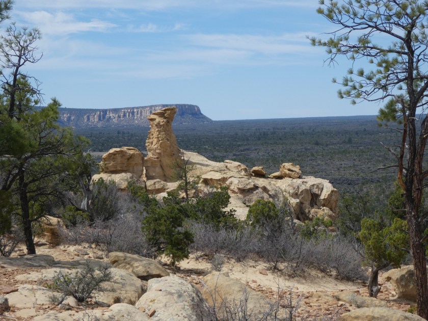
Sandstone Bluffs Overlook, El Malpais
View from Sandstone Bluff – you can see all the lava throughout the valley
La Ventana Natural Arch, El Malpais NM
Selfie in front of La Ventana Arch

We then spent quite a few hours driving across the “Chain of Craters Backcountry Byway” (4×4, high clearance recommended).  Saw lots of Cinder Cones.  Road is probably a geologist’s dream.  Too bad we are not geologists.

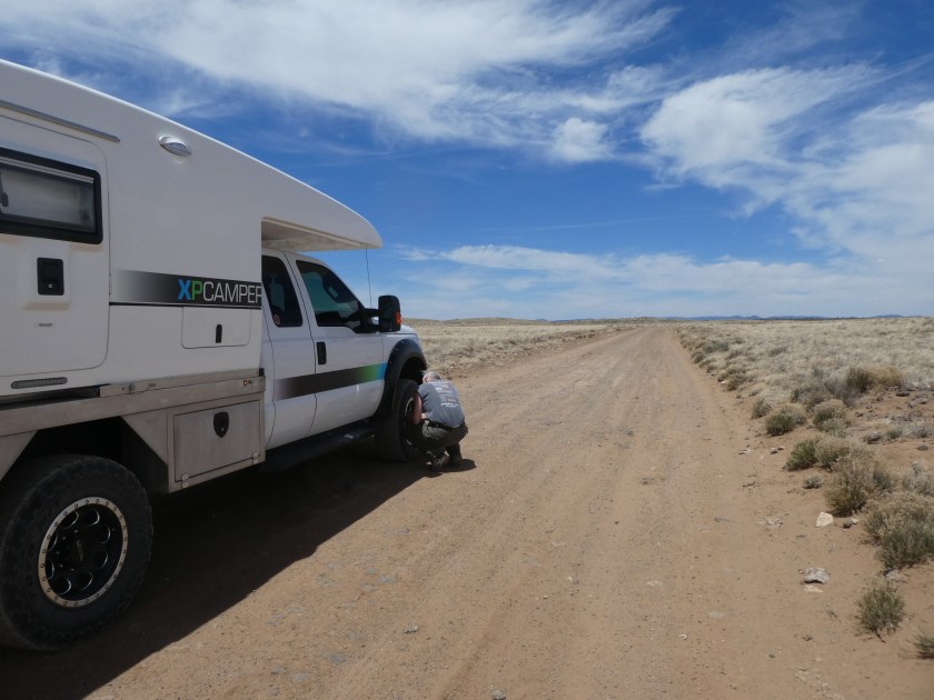
Chuck airing down the tires to start the Chain of Craters Backcountry Byway hunt for volcanos
Lots of cows along this backcountry byway
Here are a few of the Cinder Cones (from volcanos that erupted 200000 years ago)
Closer View of Cinder Cones
Lots and lots of ant hills along the byway
Got the camper pretty dirty

East Coast – October 2017

Blue Ridge Parkway

After the Overland Expo East in North Carolina, we had a chance to meander up some of the Blue Ridge Parkway.  We had run most of this on our motorcycles a few years back – but this time we were camping in our Vanagon and taking it slow.

We spent the night at Crabtree Falls campground.  The leaves were just starting to change, and you had to be careful because of all the falling acorns!  Very few people camp here in October!

Crabtree Falls Trail
Crabtree Falls
Crabtree Falls Campground

The next day we drove to Linville Falls and did the hikes there:

Linville Falls
Linville Falls
Linville Falls
Turkeys along the Parkway
Vanagon along the Blue RIdge
Jumping Off Rock Trail

East Coast – October 2017

Great Smoky Mountains National Park.

Our longest adventure to date (four weeks away from the house) was to the east coast and back.  The new camper was not quite ready, so we embarked on this 4000+ mile trip with our 1983  Vanagon.

The only firm date we had to meet was to be at Overland Expo East in Asheville, North Carolina starting 29 September.  We had several neat touristy stops in mind on our way east, but we were running late and had to boogie across the country.  (We do intend to go back a little slower and hit those spots we whizzed through someday…). Our first relaxing stop was at the Tennessee/North Carolina border: Great Smoky Mountains National Park.  We camped along side the Little River at a beautiful, relaxing site at Elkmont campgrounds.

Elkmont Campsite
Little River – Elkmont Campground
Chuck at Elkmont Campsite

We also had a chance to hike the Laurel Falls Trail.  I’d rate it as realistically easy, although a bit rocky.  The falls were nice, but not spectacular.

Laurel Falls